Drone Surveying in Central Oregon
See the whole site, measure what matters, and track what changes.
The challenge
A large site is difficult to understand from a few ground-level views. You may need to compare terrain, check stockpile quantities, or show your team how work has progressed.
How we help
Give your team a measured view from above.
Povey & Associates combines aerial data collection with surveying expertise to create site maps, elevation models, and volume measurements. Our FAA-certified pilots use fixed-wing and quadcopter drones to capture the information your planners, engineers, and field teams need.
Aerial data you can put to work.
Mapping, measurement, and documentation for sites of every scale.
Aerial Mapping
High-resolution orthomosaic maps and digital elevation models for planning, design, and documentation.
Volumetric Calculations
Accurate stockpile measurements and cut/fill calculations for construction and mining operations.
Construction Monitoring
Regular progress documentation with visual records and comparison analysis throughout your build.
Agricultural Assessment
Crop health monitoring, irrigation planning, and drainage analysis for Central Oregon farms and ranches.
Real Estate Photography
Professional aerial photography and video for property marketing and development visualization.
Infrastructure Inspection
Safe, efficient inspection of roofs, towers, bridges, and other structures without scaffolding or lifts.
Our Drone Fleet
The right aircraft for the job, flown by a licensed surveyor
DJI Matrice 350 with Zenmuse L2 LiDAR
Our DJI M350 carries the Zenmuse L2 LiDAR sensor and is the aircraft we fly for LiDAR work. It measures the ground directly with laser pulses, so it captures accurate terrain even under tree cover and produces dense point clouds for topographic mapping and 3D site models.
WingtraOne Fixed-Wing Mapping Drone
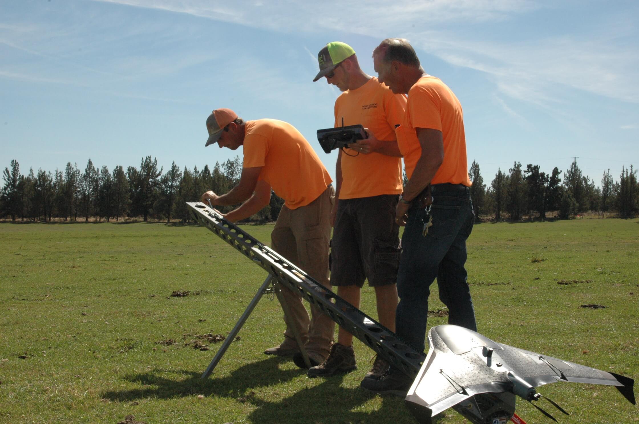
Our WingtraOne takes off and lands like a helicopter, then flies like a plane. It is our photogrammetry workhorse: it covers large areas in a single flight with a high-resolution survey camera and produces orthomosaic maps, digital elevation models, and terrain models for whole sites, ranches, and road corridors.
DJI Phantom 4 Pro Quadcopter
Our DJI Phantom 4 Pro handles close-up work: 360-degree views, still images or video, and a 20-megapixel camera with single-shot, burst, and time-lapse modes in HD. A quadcopter flies in tight spaces where a fixed-wing aircraft cannot, which makes it our tool for site photography and real estate tours.
Every flight is flown by an FAA Part 107 certified and licensed UAS pilot with years of surveying experience. Povey & Associates Drone Services is licensed and insured. USA DOT FAA #3920299.
Drone Services by Industry
Generations of surveying experience plus the power of flight
Municipalities
Cities, counties, and rural districts in Deschutes, Jefferson, and Crook counties use our drones to document growth, find roads that need repair, judge how much snow removal is needed before sending crews, monitor trees and terrain, inspect building exteriors, support code enforcement, and assess storm damage.
Mining and Aggregates
We measure the material removed, eroded, or changed over time: stockpile tracking, material removal tracking, and accurate terrain models. Large, precise data sets in a few hours, with no outside imagery needed.
Land Surveying
A safer, more cost-effective way to collect data in rugged terrain that might otherwise be impossible to reach. One quick flight captures millions of geo-referenced data points at sharp resolution for multiple uses.
Agriculture and Ranches
Topographic surveys, crop management, water capture planning, planting patterns and soil analysis, livestock and herd health checks, and locating stray livestock. Ranch management and restoration from the air.
Builders and Contractors
Track job progress, run job-site surveys, build a visual history of the project, and measure excavation by volume, width, and distance. Scheduled flights keep reports current and projects on budget.
Real Estate
Virtual exterior tours of lots, land, ranches, farms, and estates. A bird's-eye, 360-degree view that improves how a listing shows and shortens days on market.
Frequently Asked Questions
Common questions about drone surveying services
Explore Our Other Services
Need Aerial Mapping?
Contact us today for a consultation and free estimate.